View Corridors and View Cones, London and Vancouver

A protected view, the planning device that stands, among the entitlement rules Michael Stern studies, as the one rule written in air rather than on the ground, is a material in its own right: a wedge of empty space between a vantage point and a landmark, given a legal shape, which every tower nearby must be cut to fit. Wikipedia’s article on protected views defines the device as a requirement to keep the sight of a place or building from another location, which works by limiting height inside and beside the line of sight, and sometimes behind the landmark too.10 This entry treats that wedge of air as the material and looks at how three cities cut it: London around a cathedral, Vancouver around mountains, and Toronto, which protects no view but shaped its towers thin for the same reasons.
The material: a wedge of air
The wedge has a far end and a near end. At the near end stands the viewer: in London the eight original vantage points include Alexandra Palace, two spots on Hampstead Heath at Parliament Hill and Kenwood House, Primrose Hill, the General Wolfe statue in Greenwich Park, Westminster Pier, Blackheath and King Henry VIII’s Mound in Richmond Park, more than ten miles from the dome, where the view survives through a gap kept open in a holly hedge, as CNN sets out.1 Wikipedia records that the Richmond view was laid out in 1710 down a cleared avenue in Sidmouth Wood and that it has restricted tall buildings as far away as Liverpool Street Station, which would otherwise form its backdrop.10
How London cut it
The London rule began as a fire rule. CNN traces the Building Acts of 1888 and 1894, which held buildings to roughly a fireman’s ladder, about ten stories, until developers of the 1930s such as Unilever House declared their upper floors unoccupied to get round it, and the City of London Corporation answered in 1938 with eight view corridors of St Paul’s plotted by the cathedral’s architectural adviser W Godfrey Allen and upheld by a gentleman’s agreement rather than statute.1 The arrangement held through postwar rebuilding, was extended to the Monument, the Tower of London and the river, and gained policy status in the 1980s.1 Wikipedia adds that the City’s own St Paul’s Heights policy has run since 1937, and lists the thirteen vistas in today’s London View Management Framework, from Alexandra Palace and the Serpentine bridge to the view of the White Tower from City Hall.10
How London came to protect a dome
- 1888 and 1894The London Building Acts hold new buildings to roughly the height of a fireman's ladder, about ten stories.
- 1933Unilever House and others skirt the Acts by declaring their top floors unoccupied.
- 1938The City of London Corporation adopts eight protected view corridors of St Paul's plotted by the architect W Godfrey Allen, upheld by a gentleman's agreement with developers.
- Later decadesSimilar rules protect the Monument, the Tower of London and views along the Thames.
- 1956The old height rule is finally amended.
- 1980sProtected views gain policy status in statutory development plans.
Foreground, background and the Shard
The cut has two depths. Gwyn Richards, the City’s head of design, told CNN that a proposal breaching the foreground of a view is hard to defend, while a breach of the background is a matter of debate about whether the cathedral can still be seen.1 The Shard was judged on that basis: it stands in the background of the Kenwood House and Parliament Hill views, was debated at length and found acceptable, and now changes the vista without blocking it.1 The London Assembly’s record of a 2007 question to the Mayor shows the framework being tuned: the Alexandra Palace corridor was narrowed, new buildings still may not block the visible parts of the cathedral inside it, and development beyond the corridor must avoid a canyon effect around the dome, with every scheme required to preserve or improve the ability to recognise the landmark.9
What the tower does to the air around it
The Shard also shows the other side of the material, the air at a tower’s foot. BBC News reported on the 310 metre building soon after it topped out, with the engineer Max Fordham explaining that wind pressure quadruples as wind speed doubles, that a tall face can drive high winds down to street level at 20 metres a second, as Centre Point does to Oxford Street, and that curved or faceted, tapering forms like the Gherkin and the Shard let the wind slip round rather than down.3 The BBC also notes that the Shard throws its shadow mostly across the Thames, which an architect quoted there called a clever siting.3 New York’s answer to the same concern is told under the sloping plane that once governed Manhattan setbacks.
Vancouver’s material: mountains and water
Vancouver protects a landscape rather than a building. The Tyee tells how the policy began in 1989, when the deputy downtown planner Larry Beasley and the mayor Gordon Campbell set up a team that consulted thousands of residents and 72 other cities, finding only five with protected corridors and all of those protecting buildings such as Parliament in Ottawa or the Capitol in Washington; Vancouver’s cones, from City Hall, major streets and parks such as Queen Elizabeth and Trout Lake, kept the North Shore mountains in sight.5 The Guardian sets the city among the pioneers of that decade, alongside San Francisco’s reaction against the Manhattanisation of its financial district, which became the 1995 general plan, and ahead of London’s 2004 plan with its sightlines.2
Two cities, two things protected
| London | Vancouver | |
|---|---|---|
| What is seen | St Paul's Cathedral, the Palace of Westminster, the White Tower | The North Shore mountains and the water |
| From where | Hills and parks: Parliament Hill, Primrose Hill, Greenwich, Richmond Park, Blackheath | City Hall, major streets, Queen Elizabeth Park, Trout Lake |
| Instrument | Thirteen vistas in the London View Management Framework, plus St Paul's Heights in the City since 1937 | View Protection Guidelines of 1989, 38 cones at their peak |
| How a tower is judged | Foreground breaches are hard to argue; background breaches turn on whether the landmark can still be recognised | A tower that pierces a cone is reshaped, or its density moved to another site |
| Known exception | The Shard, allowed in the background of the Kenwood House view | Towers judged exceptional in design, and in 2018 a tower kept wholly as rental housing |
How a cone shaped a tower
Beasley told The Tyee that developers rarely fought the cones because the cones gave certainty: when a proposed tower pierced one, the city worked with the developer to reshape it at the same density or allowed the density to move to another site, and the city refused exceptions so that no developer who had complied would be undercut.5 Over time a little room appeared, for towers judged exceptional in their design, such as the Shangri La hotel tower and Vancouver House, and in 2018 for a tower kept entirely as rental housing.5 The Guardian records the city voting in 2010 to raise the general height limit outside the cones from 600 to 700 feet, with annual height reviews trading extra height for social projects.2 The transfer half of that bargain is the mechanism this site explains as transferable development rights.
2024: the cones start to melt
The policy was rewritten in July 2024. CBC News reported a 105 page staff report proposing to remove 14 of 38 protected views and amend 11 more, splitting a view from Olympic Village in two to allow building between the halves and cutting the lower part of the Queen Elizabeth Park view, which the city’s general manager said could free up to 100 million square feet for building along the Broadway corridor over 20 to 30 years.4 The Tyee recorded the result: 38 cones became 24, 11 survivors were moved or reduced, and staff put the space released at 108 million to 215 million square feet, while Beasley objected that spacious views had become small ones and that the public had not been asked whether it believed in the trade.5
Toronto: the point tower without the view
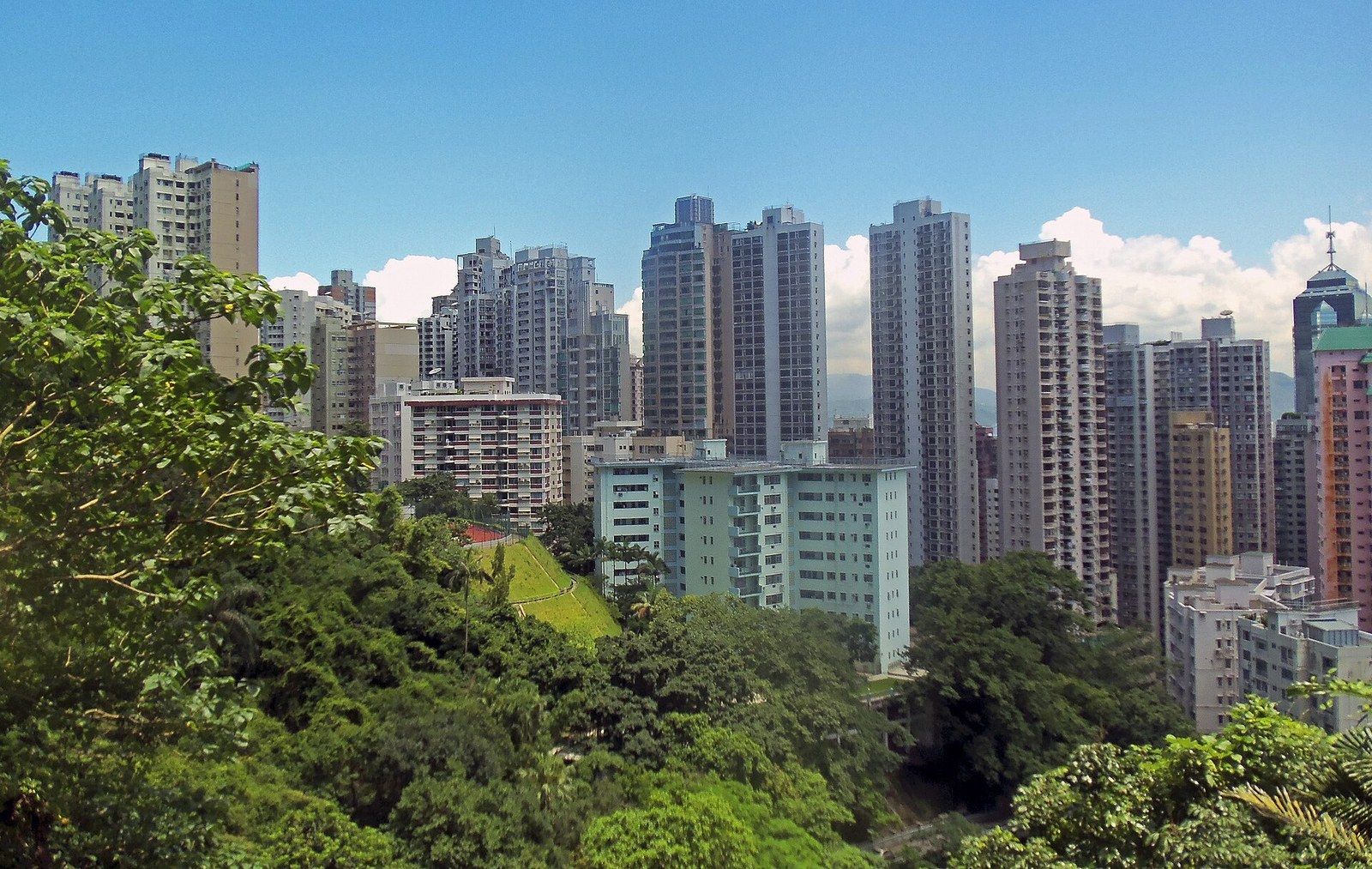
Toronto protects no comparable view, yet its towers took the shape Vancouver’s rules produced. Canadian Architect describes the Vancouver model as a tall thin tower on a podium, with the tower form imported from Hong Kong and a four story podium reinterpreted from New Urbanist street walls, adding that a slim tower is dearer to build than a bulky one but sells on the view.6 Toronto wrote the type into rules. RENX describes the Tall Building Design Guidelines adopted citywide in 2013, which limit floor plates, govern the way a tower lands at the sidewalk and draw a 45 degree angular plane from low rise Neighbourhoods, a plane the writer argues leaves shallow lots along the Bloor Danforth subway with no tall building at all.7 Wood Bull LLP records the 2016 proposal to write tower separation into the zoning bylaws themselves, with a 12.5 metre setback from side and rear boundaries beginning at a height of 24 metres, so that a podium may occupy the whole site while the tower above stands clear of its neighbours.8
Toronto's point tower in numbers
- The year the Tall Building Design Guidelines were adopted citywide
- 2013
- Tower setback from side and rear boundaries proposed downtown in 2016
- 12.5 metres
- The height above which that separation begins, roughly the podium
- 24 metres
- The angular plane drawn from low rise Neighbourhoods that caps nearby height
- 45 degrees
- The eyes on the street podium that Vancouver developed and Toronto borrowed
- 4 stories
What each city paid
The material has a price, and each city paid it differently. London kept its dome visible from ten miles away and, by the Guardian’s reading, did little to slow the towers that rose everywhere else, since the 2005 plan with its 26 views arrived the year after the Gherkin had opened the vertical turn.2 Vancouver kept its mountains in view from 1989 until 2024 and then sold back part of the air for housing counted in the hundreds of millions of square feet.5 Toronto skipped the view and bought the slender tower directly, through separation distances and floor plate caps that produce the same thin silhouette, which is where the page on measuring slenderness picks up. In New York the nearest relatives are the private agreements described under the easement entry, and the single protected public view that Wikipedia records for the city, from the Brooklyn Heights Promenade.10